 ar
ar bg
bg hr
hr cs
cs da
da nl
nl fi
fi fr
fr de
de el
el hi
hi it
it ko
ko no
no pl
pl pt
pt ro
ro ru
ru es
es sv
sv tl
tl iw
iw id
id lv
lv lt
lt sr
sr sk
sk sl
sl uk
uk vi
vi et
et hu
hu th
th tr
tr fa
fa ms
ms hy
hy ka
ka ur
ur bn
bn mn
mn ta
ta kk
kk uz
uz ku
ku
wireless tiltmeters
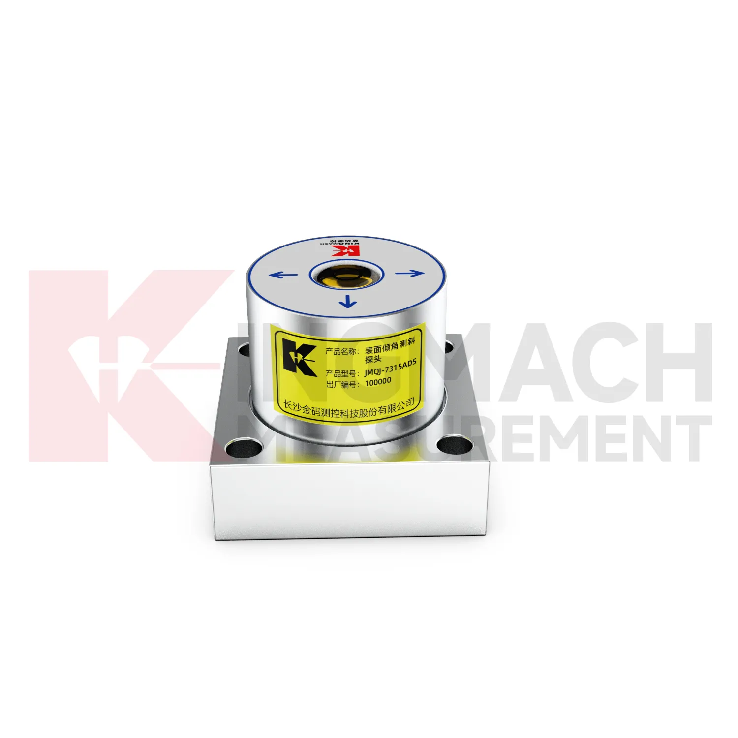
The JMQJ-7315ADS fixed tiltmeter is a key Kingmach wireless tiltmeters product for biaxial structural tilt monitoring. It uses MEMS technology, a high-precision acceleration integrated chip, differential measurement principles, 16-bit AD sampling, RS485 digital communication, a unique electronic code, and lightning protection design. The product is used to observe inclination angle change and deformation of bridges, buildings, railways, and other structures relative to the horizontal plane, including hidden parts that are difficult to observe by conventional methods. Published specifications include +/-15 degrees dual-axis measuring range, 0.001 degree resolution, 0.01 degree accuracy, DC 9V to 24V supply, power consumption below 0.5W, RS485 digital output, -30 degrees Celsius to +80 degrees Celsius operating environment, 55 mm by 55 mm by 46 mm dimensions, IP68 protection, and 0.6 kg weight.
Application of wireless tiltmeters
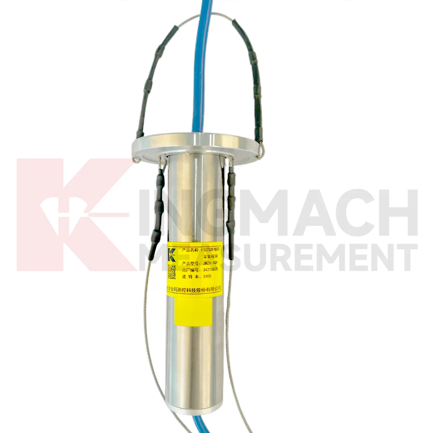
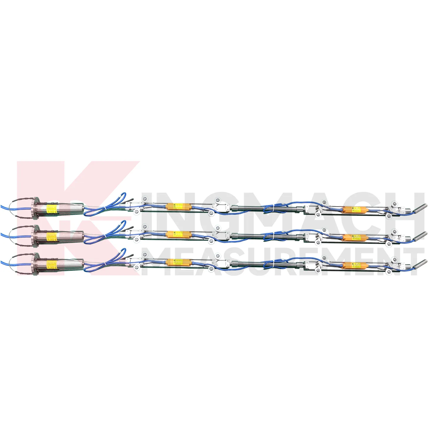
Slope and geological hazard monitoring use wireless tiltmeters to detect internal movement before the surface condition becomes clear. JMQJ-7915ATS is especially relevant because its multi-point in-place inclinometer string can observe deformation at different depths inside a borehole. JMZX-7100L can also be used for sliding inclinometer profiling in geotechnical slopes, dams, embankment slopes, and port engineering. Slope tilt or inclinometer data should be read with rainfall, groundwater, crack width, surface displacement, retaining structure movement, and construction disturbance. The key question is often depth: is the movement shallow, deep, or concentrated along one weak layer? A borehole profile with consistent point naming and stable orientation gives engineers better evidence for warning, inspection, and stabilization planning.
The future of wireless tiltmeters
Future wireless tiltmeters will be reviewed more often with environmental and construction context. Tilt readings can change with rainfall, groundwater, temperature, excavation, traffic, wind, reservoir level, vibration, and loading. A platform that displays tilt beside these conditions can help engineers separate a temporary response from continuing deformation. Kingmach product categories include environmental monitoring, displacement sensors, settlement sensors, acquisition hardware, and visualization software, giving tilt data a natural place in a broader monitoring record. Future reporting should make relationships visible without hiding the raw angle data. When a curve changes, the engineer should be able to see nearby site events, related instruments, and inspection notes in the same review path.
Care & Maintenance of wireless tiltmeters
Temperature and environment checks help maintain wireless tiltmeters accuracy. JMQJ-7315ADS operates from -30 degrees Celsius to +80 degrees Celsius, JMQJ-7315RTU from -10 degrees Celsius to +55 degrees Celsius, and JMQJ-7915ATS from -30 degrees Celsius to +70 degrees Celsius. Temperature drift, condensation, direct sunlight, ice, and cabinet heat can affect readings or communication hardware. Maintenance records should note weather, enclosure condition, ventilation, shading, and nearby heat sources. If a tilt curve moves with daily temperature, compare it with structural temperature and other sensors before treating it as deformation. Environmental review does not weaken the warning; it makes the warning more credible by filtering out explainable operating effects.
Kingmach wireless tiltmeters
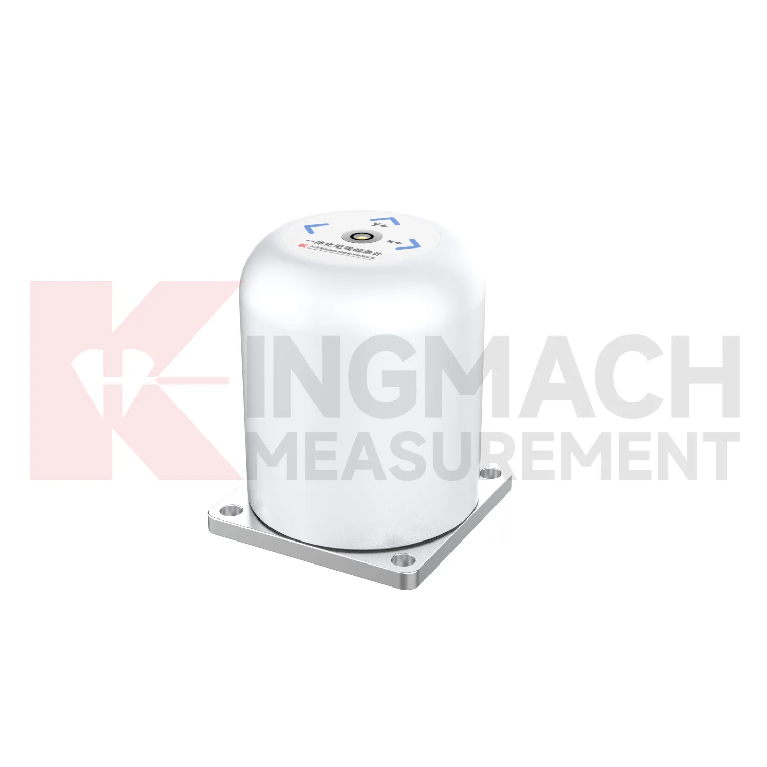
Kingmach wireless tiltmeters help engineers measure angular change in structures and ground where visual inspection cannot show early deformation. A small tilt in a bridge pier, retaining wall, building column, railway structure, or slope borehole can indicate load change, foundation movement, lateral soil pressure, or hidden internal displacement. Kingmach products use MEMS sensing, digital communication, sealed housings, and automated acquisition paths to support long-term monitoring. Fixed sensors such as JMQJ-7315ADS can measure biaxial tilt relative to the horizontal plane, while vertical in-place inclinometer systems observe multi-point deformation inside boreholes. The value of tilt monitoring is not only the angle value; it is the way repeated readings show rate, direction, and timing. When the baseline, location, axis direction, and structural event are recorded clearly, tilt data becomes a practical warning layer for civil works.
FAQ
Q: How should wireless tiltmeters be installed?
A: The mounting surface or borehole position should be stable, the axis direction must be recorded, and the baseline should be saved after the instrument settles.Q: Why is axis direction important?
A: Tilt values only have engineering meaning when the positive and negative directions are tied to the structure, slope, tunnel, or borehole drawing.Q: Can these instruments work in wet sites?
A: Several Kingmach models list IP65, IP67, or IP68 protection, but glands, connectors, cabinets, and cable entries still need field inspection.Q: What should be checked during commissioning?
A: Check model, range, serial number, communication, power, baseline, point name, mounting photo, channel address, and related site condition.Q: Can a tiltmeter be reset after installation?
A: It can be re-baselined when necessary, but the old value, new value, reason, date, and technician should remain visible in the record.
Reviews
Christopher Martinez
Very satisfied with the readouts & data loggers. User-friendly interface and supports multiple sensor inputs.
Andrew Lee
The visualization software is intuitive and powerful. It helps us analyze monitoring data efficiently.
Latest Inquiries
To protect the privacy of our buyers, only public service email domains like Gmail, Yahoo, and MSN will be displayed. Additionally, only a limited portion of the inquiry content will be shown.
Charlotte***@gmail.comUnited Arab Emirates
Hi, we require instrumentation cables suitable for harsh environments. Could you advise on specifica...
Emma***@gmail.comCanada
Dear Sir/Madam, we are interested in displacement transducers and settlement sensors for a geotechni...